Mt. Yamnuska–Jun 30, 2012

This scramble is always a classic, at about 11km and 900m elevation gain.  This time I had the pleasure of bringing along a few people who were new to scrambling, to show them that the easier ones really aren’t that bad.  Our whole group had no problems with the cable crossing, and everyone loved the scree run at the end!  Here’s me coming down the scree slope.

The summit was very busy as it was the Canada Day long weekend, and we actually bumped into another group from the Calgary Outdoor Club – it was very interesting to see what a different mix of people they had from CORA.  Seemed like a much younger group.

In summary, this scramble is a very good way to get yourself used to the steep slopes, scree, and exposure to falls that harder scrambles are full of.  Highly recommended!

Categories: Trail Reports | Tags: , | Leave a comment

Nihahi Ridge–June 10, 2012

After a week of wet, icky weather, I was a bit worried that we were going to have an unpleasant day on this short but steep hike.  Nihahi Ridge is a very popular hike that starts from the Little Elbow campground and very quickly gains 500-600m of elevation over about 9km.  It has the option of turning into a scramble (you can head all the way to Consolation Ridge if you wish), but we chose to keep it easier and leave the scramble out. 

Luckily for us, the weather held out and we only got a tiny sprinkling of rain!  The temperature was just perfect for the strenuous ascent.  Unfortunately freezing levels had dropped over the week, so we couldn’t make it all the way to the ridge due to some very slippery spring snow that had fallen.  Overall though, the views were great, especially up the Elbow River as above.  We all marvelled at how much snow Moose Mountain had accumulated in the week!  This was also my first hike with CORA as a fully-fledged organizer, so I was very happy it went well.

Categories: Trail Reports | Tags: , , , | Leave a comment

French Hiking–Pont d’Espagne to Refuge Wallon

pkirby_20120531_0143

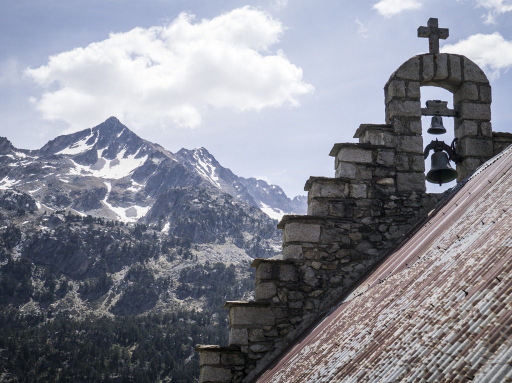
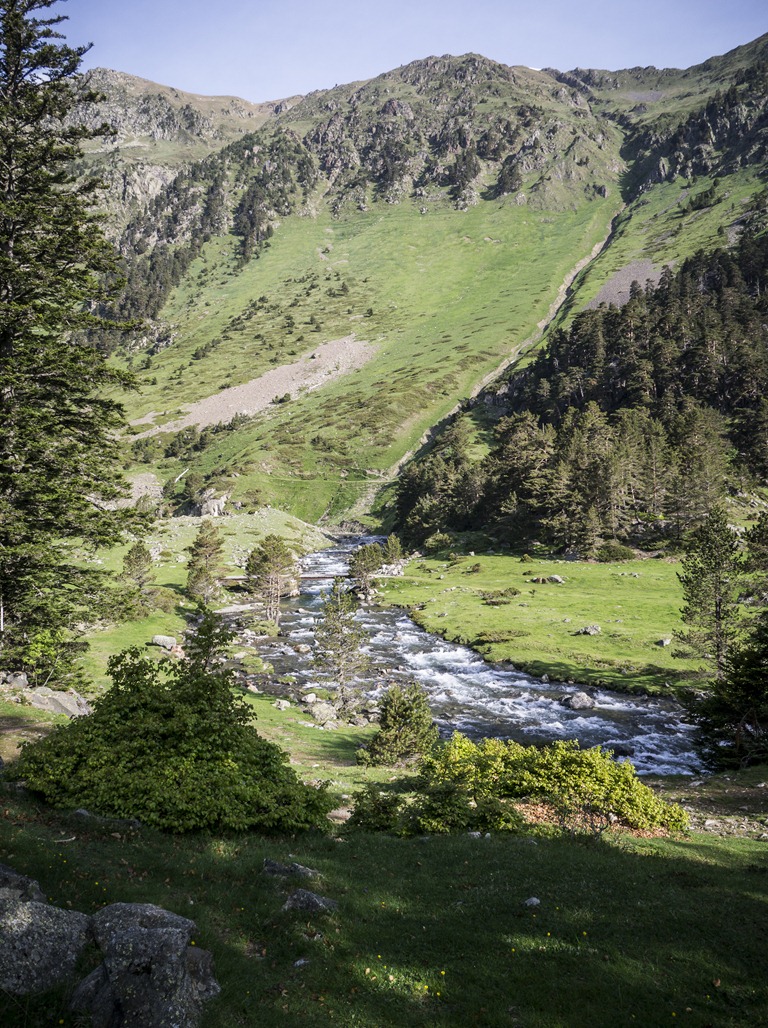
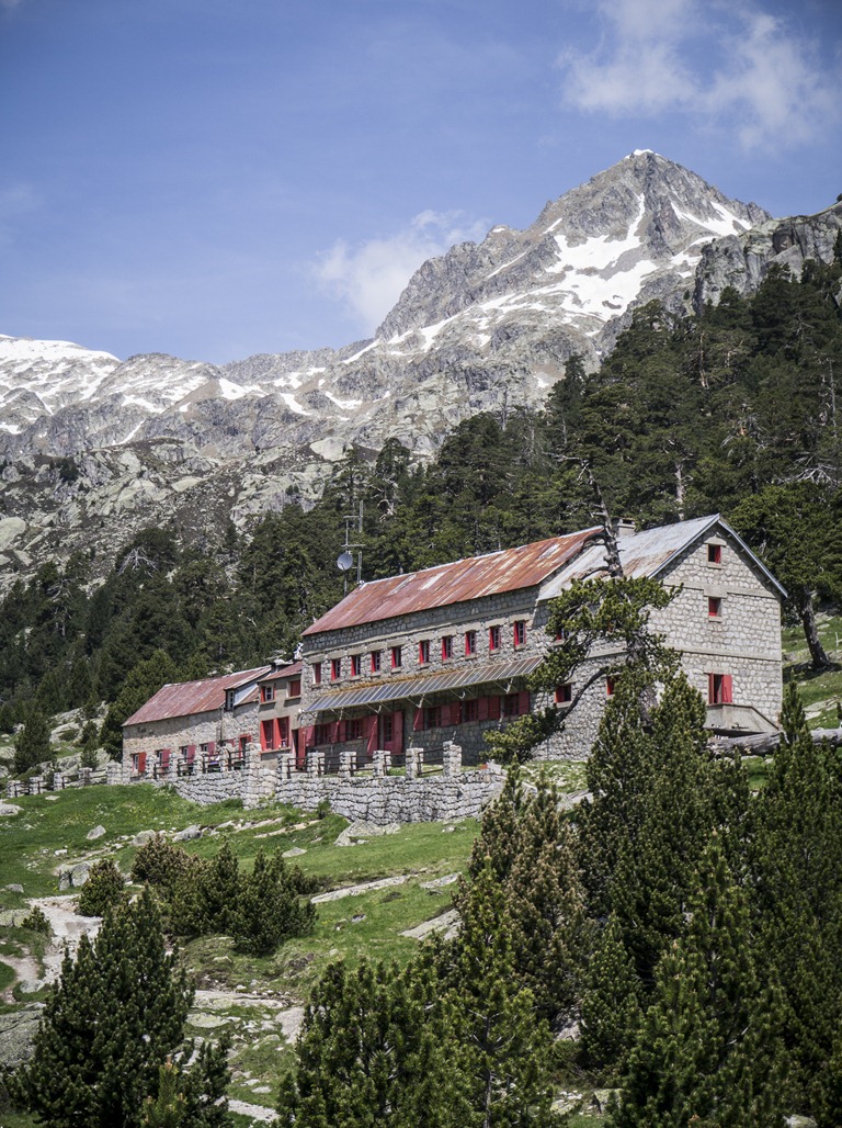
My best friend and I were in south France for ten days, and had the opportunity to do some hiking while we were there.  We hiked approximately 15km from Pont d’Espagne near the town of Cauterets to a French mountain hut called Refuge Wallon.  I was amazed by how different the landscape was compared to the Canadian Rockies – many of the mountains are green nearly all the way up, and the valleys are essentially all lush fields with small patches of wildflowers all over.  Generally it just naturally “felt” European.

pkirby_20120531_0100

The trails are well-maintained and as are the mountain huts – although sadly we arrived one day too early to enjoy a beer in the middle of the mountains, 5km from the Spanish border!

pkirby_20120531_0132

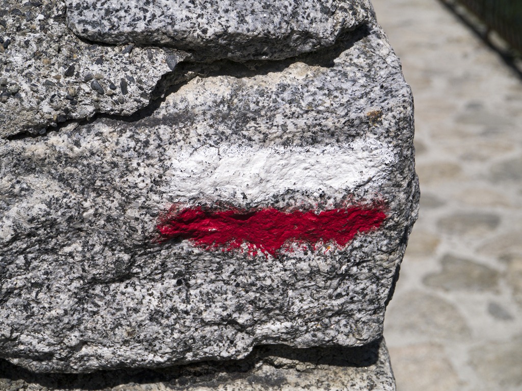
A section of the trail we took is part of the GR10 (Grande Randonnée 10) route that goes from the Atlantic Pyrénées all the way to the Mediterranean.  Based on the absolutely stunning landscape, that route is now 100% on my bucket list.  That or maybe the GR11 which is the GR10’s parallel route on the Spanish side of the Pyrénées.  Below is the symbol that marks the GR paths – it was all over!

pkirby_20120531_0156

If you plan on spending any time in France, I cannot recommend hiking in the Pyrénées enough!  I’ve never been to the alps, but I’ve heard they’re much like the Rockies, whereas this mountain range is an entirely different beast!

Also I must highly recommend my uncle’s B&B that we stayed at while we were there.  Check them out: http://www.chezpasset.com

Categories: Uncategorized | Leave a comment

Aylmer Lookout – May 20, 2012

pkirby_20120520_0058

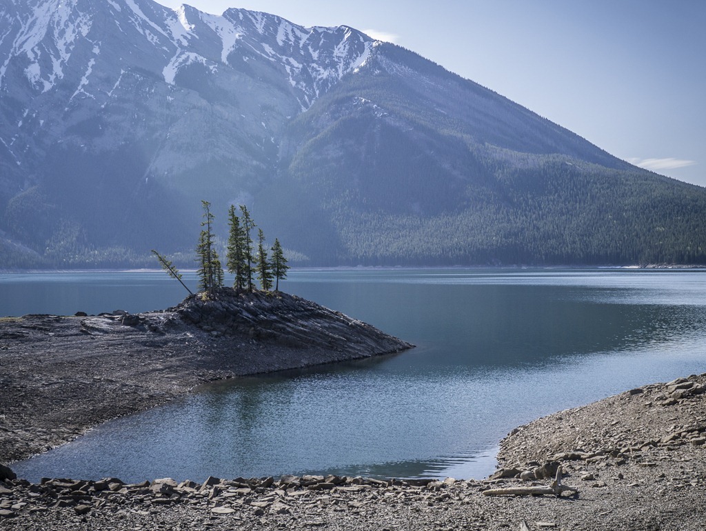
This was a fantastic but long (23km) hike near Lake Minnewanka.  The views were amazing from the top and along the lake, and we had a great bunch of people out hiking with us.  The route takes you along the lake, then diverts up a steep set of switchbacks to the lookout.  We had the option of going to Aylmer Pass as well, but it was snowbound at that time.  I’d definitely suggest not doing this hike in one day unless you plan to go to the hot springs after and soak your feet.  Conveniently, there is a backcountry campground at the base of the ascent to the lookout, so it would be easy to split this into an overnight trip that would be quite enjoyable.  Just watch for bears!

No GPS track for this one as my GPS batteries sadly died partway due to the length.

Categories: Trail Reports | Tags: , | Leave a comment

Eagle Hill and “D4 Hill” – April 28, 2012

Finally some sunshine and melted snow!  I’d consider this to be the first hike that I’ve done in the non-risky shoulder season – by non-risky, I mean generally dry and not likely to involve unexpected snowshoeing.  Of course, with the mountains being as they are, that’s always a possibility, but the area has had a wonderful stretch of rain and sun which has really helped to keep snow levels down!

Eagle Hill itself is quite an easy hike, at about 13k round trip with rolling hills equating to 300-400 meters of elevation gain.  The route takes you by Sibbald Pond, which at this time of year was filled with some sort of waterfowl – we could hear them from a ways off quacking and such!  Following that, it sticks to the bottom of the nearby ridge, eventually ascending sharply to the top of the hill.  The views from the top are spectacular: to the south, you can see a good chunk of Kananaskis Country, including a bit of Moose Mountain, and Deer Ridge nearby.  To the north, there is a gorgeous view of the eastern Rockies – Yamnuska, Mount Baldy and Barrier Lake are all visible.

On the way back, we chose to do a little bit of bushwhacking onto the northern part of Deer Ridge (where there is no trail).  We dubbed it “D4 Hill” as the uphill definitely changed the difficulty of the hike overall for us (CORA uses a rating system from D1-D8 to rank the difficulty of activities).  Navigating there involved crossing over the decidedly marshy valley area between the two ridges.  It was a little wet!  Once we got up, there wasn’t much of a view, so we headed back down, but it was good navigation practice.  I would definitely suggest doing the real documented route for Deer Ridge if you head out this way!  This increased our distance to closer to 15k, and added another 100-200m of elevation.

Overall, it was a great day out in the mountains, and made all of us excited for more routes becoming less snowbound very soon!
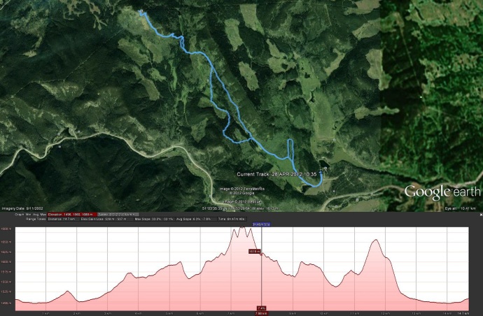
Elevation Profile and Route

Categories: Trail Reports | Tags: , , | Leave a comment

Cox Hill – April 15, 2012

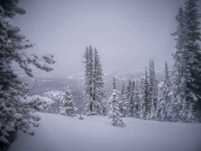
The view looking down near the summit

What a great start to the season!  A somewhat taxing hike, mostly due to the snow combined with skipping a few switchbacks to head straight up the hill at one point.  That meant we had a fun time sliding back down though!  This is definitely one to revisit in the summer, I imagine the sunlight dappling through the many tree-filled ridges on this hike would be extremely beautiful.

This hike does definitely beg some tips on shoulder-season hiking though.  My friend from the Calgary Outdoor Recreation Association (CORA), Becky has some good tips here.  But some additional ones I would add are:

  • Bring sunscreen.  Even on a day like this was, with overcast skies and <5m visibility at the summit, the reflection of even limited sunlight off the snow can result in some pretty nasty burns.  I forgot to reapply and ended up quite red-faced on Monday!
  • Add extra time to any estimates given for hiking time that you mind find in guidebooks or websites.  Even a small amount of snow can be deceptively hard to hike in, and can add significant time to your hike.  I tend to assume that we’ll be moving at half of our usual pace if there’s non-patchy snow covering the trail.
  • Bring your camera!  Don’t assume that all the views will be unappealing.  Pristine, untouched snow can be very beautiful!

Elevation Profile and Route

Categories: Trail Reports | Tags: , , , | Leave a comment

Create a free website or blog at WordPress.com.